About SC Aerial Solutions
At SC Aerial Solutions, we help construction professionals, developers, engineers, and property owners make better decisions through accurate aerial data.
We specialize in drone mapping, orthomosaic generation, 3D site modeling, construction progress monitoring, stockpile volume measurements, and aerial documentation that provide a clear picture of every stage of a project. Our goal is simple: deliver reliable information that improves communication, supports planning, and documents progress with confidence.
Technology is only valuable when it produces results you can trust. That’s why we focus on consistent data collection, professional execution, and dependable service on every project.
Why Choose SC Aerial Solutions?
FAA Certified & Fully Insured
Every flight is conducted by an FAA Part 107 Certified Remote Pilot and backed by full commercial insurance. Safety, compliance, and professionalism are the foundation of every mission.
Accurate, Repeatable Data
Using RTK-enabled drone technology, we capture high-resolution aerial data that produces detailed orthomosaic maps, interactive 3D models, and consistent progress documentation throughout the life of a project.
Built for Construction & Commercial Projects
We work with general contractors, developers, engineers, property managers, municipalities, and commercial clients who need reliable aerial information—not just attractive photographs. Our deliverables support planning, project management, stakeholder communication, and long-term documentation.
Dependable Service
Construction schedules move quickly, and reliable partners matter. We prioritize responsive communication, consistent scheduling, fast turnaround times, and professional results so you can focus on keeping your project moving forward.
Our Services
- Drone Mapping & Orthomosaic Generation
- Construction Progress Monitoring
- 3D Site Models
- Stockpile Volume Measurements
- Aerial Site Documentation
- Commercial Property Inspections
- High-Resolution Aerial Photography
Our Mission
Our mission is to provide accurate aerial data that gives clients greater visibility into their projects, improves communication, and supports better decision-making. By combining advanced drone technology with dependable service, we help organizations document progress, monitor change, and manage projects more efficiently.
Let’s Build Better Projects Together
Whether you need recurring construction progress updates, a detailed orthomosaic map, a 3D model, or professional aerial documentation, SC Aerial Solutions is ready to support your next project.
📞 Contact us today to schedule your free consultation and learn how drone mapping can provide valuable insight throughout the life of your project.
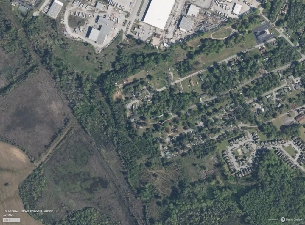
BEFORE
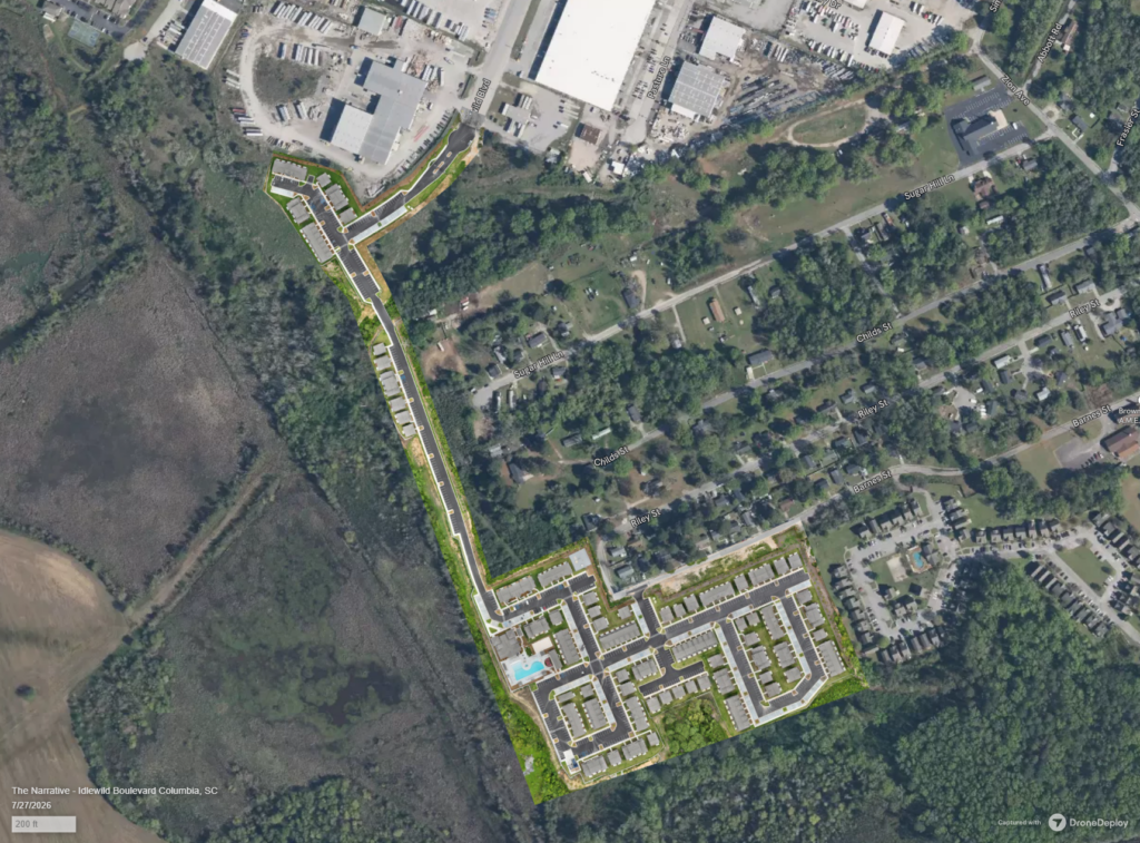
AFTER